Mary Ellen Lepionka, July 10, 2017

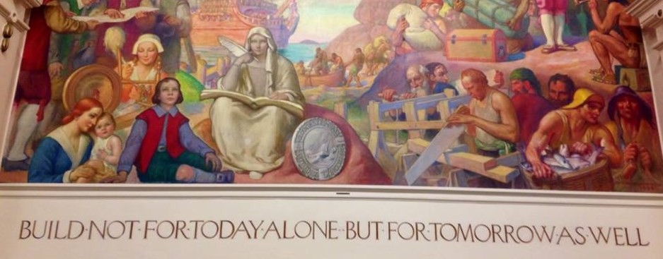
Underground Landscape. 1989. Albert Alcalay (1917-2008)
Pole Hill in Riverview, some say Poles Hill, was the place where shamans went to read the sky for the people living at Wanaskwiwam in Riverview, Gloucester. Algonquians sited their villages near landscapes that could serve as astronomical observatories—hilltops shaped like shallow bowls with false horizons where watchers at the center could see the slow dance between earth and sky—hilltops with boulders to align, marking sightlines to celestial objects and events on those horizons—the rise and fall of the Pleiades; the cycles of the sun and moon; the warriors hunting and wounding the great bear; the bear’s hibernation and recovery; and special times—first planting of seeds, initiation of the youth, green corn harvest, ascension of the spirits of the dead on the trail of bright stars to the sky world under Draco’s fearsome protection.
According to geologists, Native skywatchers used fire and percussion to shape glacial erratics on Pole Hill and reduced their bases to a layer of gravel on which the positions of the heavy stones could be adjusted to match observations. Alignments show that the sky was different then, because of Earth’s wobbly progress, charted by astronomers. The North Star was not Polaris but a bright star in Draco called Thuban. That was between 2,500 and 4,000 years ago. As a consequence, today’s summer and winter solstice sunrises and sunsets are slightly askew (about 10 degrees west) of their ancient sightlines.
Pole Hill was a glacial heath then, treeless. It was a ceremonial landscape as well as an astronomical observatory. Some modified boulders can still be seen as effigy stones if you know what to look for: representations of the snake, a powerful underworld spirit; spirit animals—turtle, mountain lion, whale; abstract symbols—triangle of healing, numerical tally, standing stones, stone circles, wedged-open portals to the spirit world. And Manitou perhaps—a large leaning spall of granite shaped with the stylized head and shoulders of the Great Spirit. According to archaeologists, other Native sites in New England feature stones like these.
Awesome discoveries, but we cannot pretend to share the Algonquians’ spiritual experience. Their world and daily life were suffused with dangerous spirits and the need to predict, propitiate, mitigate, attract, distract, appease, repel, or exclude them. The Native culture of respect for all things was based on fear—fear that a particular person or tree or animal was not that person or tree or animal at all, but really a demon, or a witch, an enemy in disguise, a wandering ancestor, a shape changer, spirit guide, omen, warning, messenger from the spirit world, avatar of the culture hero Glooscap, or a random manifestation escaped from somebody’s dream. So romanticists are quite mistaken. I muster mostly scorn for new age spiritualists and cultists who misappropriate Native American religious symbols and practices.
But we can share the awesomeness. Wanaskwiwam villagers came to their sacred place at the north entrance on Riverview Road and from the harbor at the south entrance on Sunset Hill Road, the trail bisecting the hill. According to ethnographers, just inside the entrances in small rock-ringed depressions, the people stopped for ritual purification with water and smoke. The signs are still there. In 2011, I walked into the trail from the north on a hunch. I had identified Riverview as the possible site of an Algonquian village, since proven, and knew that such a village would have needed a hill for the skywatchers to do their work. From the trail I climbed an escarpment that seemed to offer access—perilously, an old lady with camera and cane, losing a sneaker—and came out on a ribbon of bedrock. It led directly to a large standalone granite boulder that clearly had been shaped by human hand. I dubbed it “the gnomon” on sight. I knew I was at the center of a solar array.
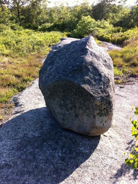
Sunset Hill Gnomon C
Over the next five years, I and several experts studied the site. I recruited Mark Carlotto to locate the other stones in the solstice and equinox arrays, and he calculated the angles, azimuths, astronomical ages, and probabilities involved. We have given talks and published papers in the Bulletin of the Massachusetts Archaeological Society and the journal of the New England Antiquities Research Association but have not yet been able to get the state to recognize Pole Hill as an archaeological site. State policy is to deny Native agency in all above-ground stone features, ignoring empirical evidence to the contrary, including even pre-Contact radiocarbon dates in many cases.

Winter Solstice Sunset 2015
Experts in archaeology, archaeoastronomy, and igneous geology from universities near and far have surveyed the site. Allen Stanish and Martin DelVecchio photographed the hill using fixed wing and helicopter drones. Nick Holland, Matt Natti, Sandy Barry, and others of the Cape Ann Trail Stewards cleared the sightlines of trees and brush, marked the trails, and erected signs. They continue to try to maintain the site, which is under constant attack by the ignorant and miscreant—those with beer bottles and graffiti paint, those who destroy signs and commit arson.
My body won’t get me to the gnomon now, but people who know go, along with the neighbors who saved Pole Hill from development in the first place and the huckleberry pickers. Some meet there for the solstices. Members of the Nipmuc Nation from Hassanamesit in Grafton and classes from Glen Urquhart School in Beverly have visited. I hope the work of documenting, authenticating, and interpreting Pole Hill will continue. The history of Native settlements and ceremonial landscapes on Cape Ann is a part of our history as well—something to take pride in now, 400 years after John Endicott divided Riverview into house and thatch lots for the founding families of Gloster Plantation. I believe enough time has passed for all of us to own all our people’s histories in this special place, our enduring Gloucester.
 Mary Ellen Lepionka lives in East Gloucester and is studying the history of Cape Ann from the Ice Age to around 1700 A.D. for a book on the subject. She is a retired publisher, author, editor, textbook developer, and college instructor with degrees in anthropology. She studied at Boston University and the University of British Columbia and has performed archaeology in Ipswich, MA, Botswana, Africa, and at Pole Hill in Gloucester, MA. Mary Ellen is a trustee of the Massachusetts Archaeological Society and serves on the Gloucester Historical Commission.
